 Bathing quality
Spiripontaine cycle discovery loop
Presentation
The medieval city of Pont-Saint-Esprit is an adventurous starting point for epicureans in search of new terroirs of excellence.
Distance: 18km, 2 hours. Average gradient 3.5% (250m+ -). Easy, hilly terrain, suitable for families, on shared RD roads and communal paths.
Half-day trip. Towns passed through: Pont-St-Esprit, St-Paulet-de-Caisson, Carsan, St-Alexandre.
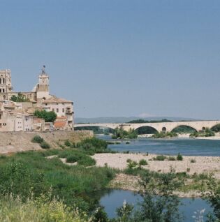
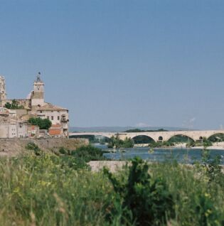
Parking at Champ de Mars near the Pont-St-Esprit Tourist Office, a town with many historic buildings including the Museum of Sacred Art located in a medieval residence. There are also many shops and services available before your departure and/or upon your arrival. This town is directly linked to the VIA RHÔNA via the medieval Gard bridge, built between 1265 and 1309, with its twenty-six arches spanning the Rhône between Lamotte-du-Rhône (left bank) and Pont-Saint-Esprit (right bank), which is the gateway to Occitan Provence.
The Tourist Information Office, located near the Champ de Mars car park, welcomes you and provides you with all the information you need about the town and the region.
Please note: Rhône Valley cycle touring route starting from Pont-St-Esprit, bicycle repair shop, summer swimming pool.
The loop starts at the Europe roundabout, marked by its fountain near the Champ de Mars car park. Then head towards St-Paulet-de-Caisson, passing the war memorial on your right. You will begin to leave the town centre behind as you climb a slight incline after passing under the railway bridge. After passing the cemetery on your left, turn right in the middle of this climb to leave the RD23 and take the Chemin du Calvaire, which continues to climb. Continue through the houses, keeping to your left.
At the end of this short hill, you will leave the houses behind and take the Chemin des Mines towards St-Paulet-de-Caisson. Continue straight ahead for several kilometres on a small country road. After a slight descent, go straight ahead at a small crossroads and take the Chemin des Sables. Turn right at the fork, then continue straight ahead at the next crossroads, still on Chemin des Sables. You will arrive at the RD256 and turn left towards the village’s cooperative wine cellar, which you can see in the distance. You have arrived in St-Paulet-de-Caisson, where local shops and services are available to quench your thirst. You can also discover the heritage of the village, including its 18th-century church.
Please note: the 12th-century St Agnès Chapel and the Chartreuse de Valbonne cycle route are nearby (see description).
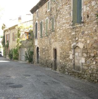
Resume the route after taking a break and crossing the village towards Carsan. Take the RD306 to leave the village, then at the roundabout, go straight on the small municipal road called Route de Carsan. You will climb a little and leave the village, then descend steeply to the village of Carsan. Be careful on the descent! Turn left for a few metres onto the RD23, then right towards the small village of Carsan on the RD306. You will climb a few kilometres to reach the centre of the village, where you can stop to discover its heritage, its church (one of the oldest in the region), its wash house and the Virgin Mary of Rouzigues, a spiritual treasure as important as its cultural value. After that, you will take the road that goes back up the village, turning left at the first intersection, then left again at the sign indicating the village exit. Turn right at the last intersection and then begin the descent of several kilometres towards the village of St-Alexandre on the small RD306, which is similar to a path, where you can enjoy the landscape.
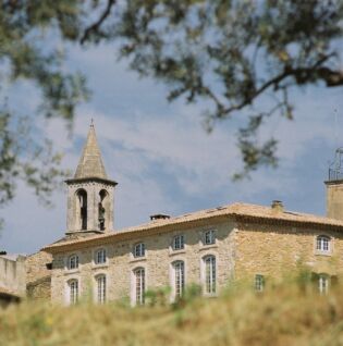
The arrival in St-Alexandre is marked by a first wash house on the right-hand side of the road, overlooking a small green area where you can take a break. After leaving this spot, continue along the RD306 for 200 metres, then take the first left onto a small path. You will arrive at the small 12th-century village of St-Alexandre, characterised by its one-way traffic system running counter-clockwise, where a second wash house welcomes you. We recommend stopping to visit the village’s heritage sites, including the 11th-century Romanesque church and its bell tower, the chapels and the war memorial, as well as stopping for refreshments at the village inn. You can also admire the magnificent panorama of the Spiripontaine plain, the Rhône valley and Mont Ventoux. The departure from the village is via the small Espéran path, after going around three quarters of the village from the wash house.
Once on the plain, turn left towards Pont-St-Esprit via the Chemin Voie Romaine, continuing straight ahead for several kilometres. Then turn right onto Chemin de Mas Conil, just after a huge cypress hedge, to reach the houses of Pont-St-Esprit. Once you reach the housing estate, turn left onto Chemin St André and follow it for a few kilometres until you reach the railway line. Turn left before the railway line and continue along the road until the next stop sign, where you will see the railway line again. Then take the road to the left of the railway line, which runs alongside it and takes you close to the cemetery. At the stop sign, you will find yourself back on the route you started on. Turn right to return to the centre of Pont-St-Esprit, passing under the railway bridge.
Route information
- Boucle
- Hard coating (tar, cement, flooring)
- 18 km
- 250 m
Files to consult
Opening dates
All year round daily.
Pricing
Free access.
Activities
- Cycle tourism route
- Cycling sports